04/30/2016 Update: Store at mile 26.1 is permanently closed.
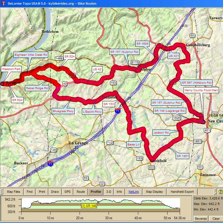
3018 – WINGS 55 Westport, Sulphur, New Castle, Campbellsburg 54.2 mi, Cumulative Climb: 3429 ft, avg: 63 ft/mile Dr. Larry Preble, Cell: (502) 724-8477 Home: (502) 509-2362 |
||
Miles |
Turn |
Road |
| 0.0 | Start | Westport Park at Ohio River |
| 0.0 | S | Main St |
| 0.2 | S | SR 524 |
| 1.0 | L | Eighteen Mile Creek Rd |
3.1 |
R |
Rebel Ridge Rd |
5.2 |
R |
Bohannon Ln |
6.0 |
R |
W US 42 |
6.6 |
L |
Bluegrass Pkwy |
9.3 |
L |
Old Sligo Rd |
9.7 |
R |
L'Espirit Pkwy |
12.1 |
R |
SR 153 |
15.8 |
L |
Bates Ln |
19.8 |
L |
SR 1861 |
22.8 |
L |
Jackson Rd |
23.9 |
R |
SR 146 |
26.1 |
Stop |
Henry County Food Mart, then turn around to go back on SR 146 |
26.2 |
R |
SR 157 |
30.4 |
R |
SR 997 (Hillsboro) |
33.9 |
L |
SR 997 |
35.3 |
L |
US 421 |
37.1 |
Stop |
Gas Station for food |
37.5 |
L |
SR 1606 |
40.5 |
R |
SR 157 |
42.6 |
L |
US 42 |
46.7 |
R |
SR 524 |
49.1 |
L |
Eighteen Mile Creek Rd |
53.2 |
R |
SR 524 |
54.0 |
S |
Main St |
54.2 |
L |
Westport Park at Ohio River |
 Map Images are copyright © 2006 Delorme, TOPO USA ® and are provided pursuant to their End User Licensing Agreement. Visit http://www.delorme.com for more information.