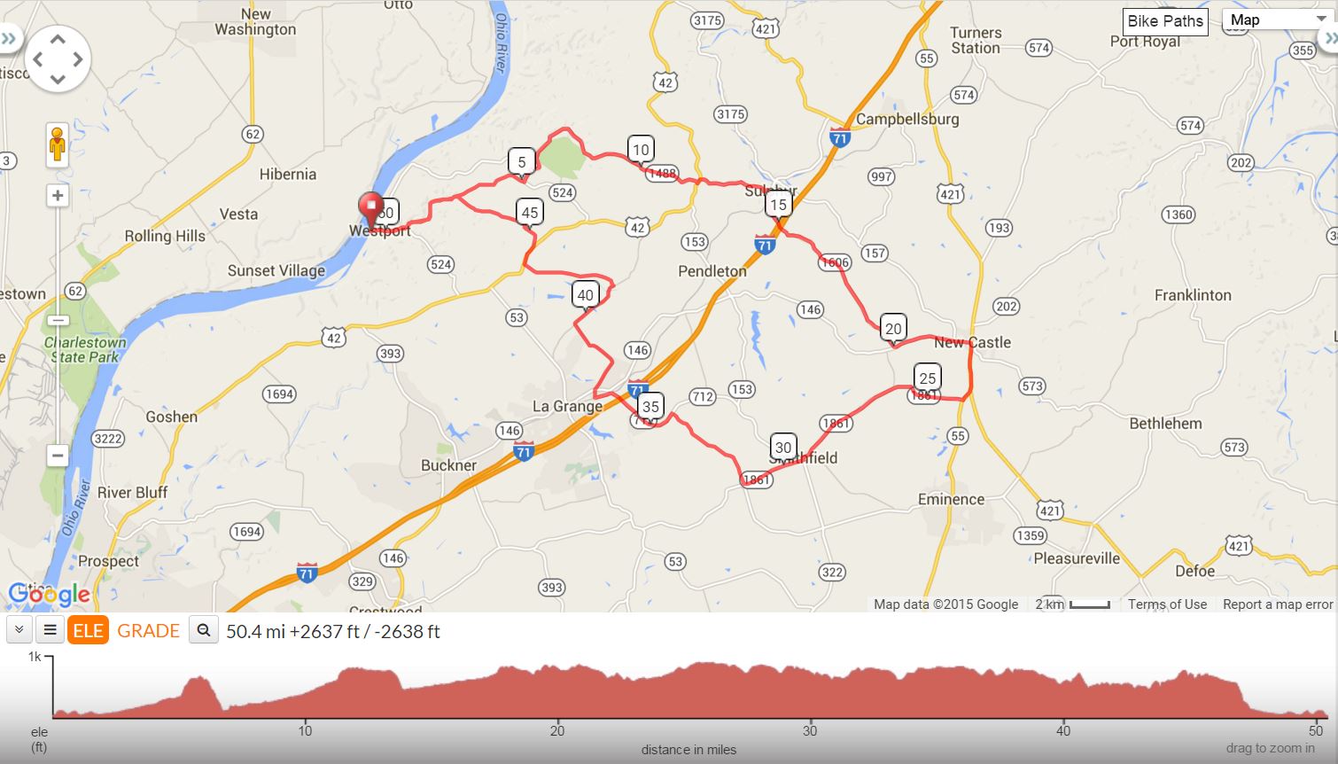
| 3017 – Wings 50 Westport, Sulphur, New Castle 49 mi, Cumulative Climb: 2638 ft, avg: 53 ft/mile Dr. Larry Preble, Cell: (502) 724-8477 Home: (502) 509-2362 |
||
| Miles | Turn | Road |
| 0.0 | Start | Westport Park at Ohio River |
| 0.0 | S | Main St |
| 0.2 | S | SR 524 |
| 1.0 | L | Eighteen Mile Creek Rd |
| 5.1 | L | SR 524 |
| 5.6 | R | SR 1488 |
| 6.9 | R | SR 1488 |
| 8.6 | L | Patton Creek Rd |
| 11.8 | L | US 42 |
| 11.9 | R | SR 157 |
| 14.0 | R | SR 1606 |
| 20.0 | L | SR 146 |
| 22.0 | S | SR 146 |
| 22.3 | R | US 421 |
| 22.9 | Stop | Valero Gas Station on the Left |
| 23.7 | S | SR 55 |
| 24.0 | R | SR 1861 |
| 29.3 | L | to stay on 1861 |
| 29.4 | R | to stay on 1861 |
| 31.2 | R | Radcliff Rd |
| 34.2 | L | SR 712 |
| 36.9 | R | to stay on 712 |
| 37.1 | X | SR 146 onto 2855 / Fort Pickens Rd |
| 39.6 | R | Old Sligo Rd |
| 41.2 | L | Bluegrass Pkwy |
| 43.8 | L | US 42 |
| 46.0 | R | SR 524 |
| 49.4 | S | Main St |
| 49.6 | L | Westport Park at Ohio River |
KEY: |
L = Left, R = Right, S = Straight, X = Cross, Red = Caution or Stop, Green =sight worth seeing, Blue = Body of Water | |
Interact with Map or to Download GPS Route