03/16/2018 Updated by John Larson
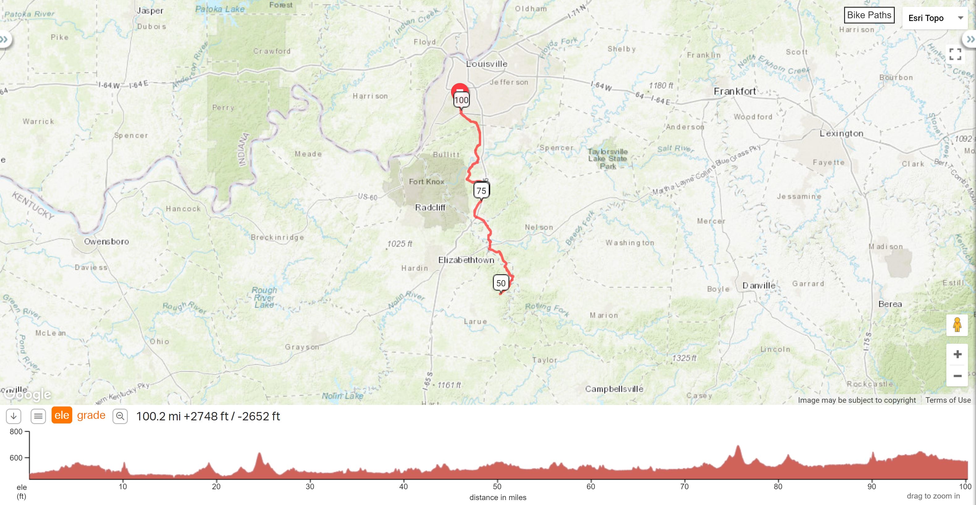
Ride starts at: WalMart, 175 Outer Loop, Louisville, KY (Outer Loop & New Cut Road)
Honest Abe Century |
||
Miles |
Turn |
Road |
0.0 |
L |
Out of K Mart |
0.1 |
R |
Stoplight @ New Cut, becomes Manslick, becomes Mt. Holly |
3.4 |
R |
National turnpike (1020) |
4.1 |
R |
@ STOP onto 1020 |
6.5 |
S |
@ STOP - blinking red light |
8.6 |
R |
@ 2673 |
11.9 |
R |
@ STOP onto 61 (SHEPHERDSVILLE) |
12.7 |
R |
Onto 1494/@SPECTRUM before marker |
17.6 |
L |
@ STOP to stay on 1494 |
20.9 |
R |
@ STOP - onto 61 |
21.4 |
• Store @ 245 on L |
|
28.7 |
R |
• Pilot (LEBANON JUNCTION) |
R |
Out of store |
|
32.9 |
R |
• @ Stop ( BOSTON Store) |
33.0 |
L |
IMMEDIATELY after RR onto Old Nelsonville Road |
34.0 |
L |
@ STOP SR 52 |
42.6 |
L |
@ STOP to stay on 52 (church on L) |
45.3 |
R |
@ STOP 31E/52 Through NEW HAVEN-stay on 31E (signs to Hodgenville) |
49.9 |
R |
LINCOLN BOYHOOD HOME |
L |
Out of lot onto 31 |
|
54.0 |
R |
• Lunch at Subway or 5 Star |
R |
Out of lot |
|
54.6 |
L |
Onto 52 (after flashing light) Lyon Station Road |
57.3 |
R |
To stay on 52 (church on right) |
65.8 |
R |
Old Nelsonville Road (100 feet before stop sign) |
66.9 |
R |
• @ Stop, Boston Store on R |
67.0 |
L |
Onto 61 @ flashing light |
78.6 |
R |
• Onto 245 Bullit County Store |
L/R |
L out of lot then R @ stop, back onto 61 |
|
79.1 |
L |
Onto 1494 (past Baptist Church on L) |
82.4 |
R |
To stay on 1494 |
87.2 |
L |
@ stop onto 61 |
88.1 |
L |
• Onto 2673(Blue Lick Rd.) after Valero |
91.3 |
L |
@ stop onto 1020 |
93.3 |
S |
@ Stop sign |
95.8 |
L |
To stay on 1020 (National Turnpike) |
96.6 |
L |
2055/Mt. Holly/ Manslick,/ New Cut |
99.9 |
L |
@ STOPLIGHT - Outer Loop |
100.0 |
R |
K-Mart |
Printer friendly Cue Sheet (pdf format)
Interact with map or Download GPS File