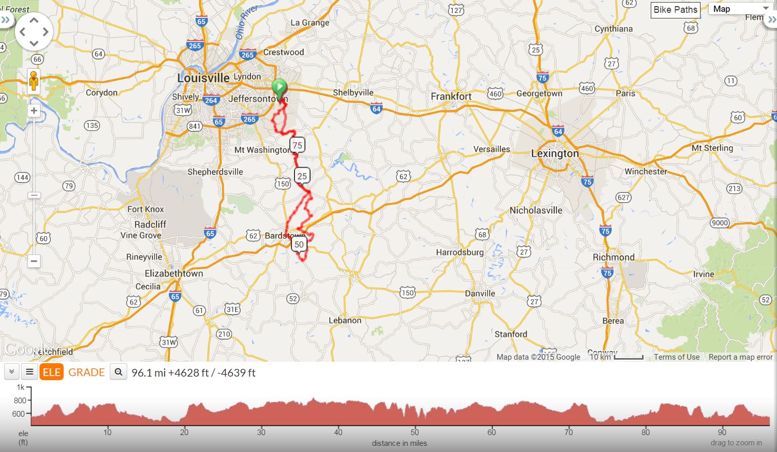
Floyds Fork Park in Southeast Louisville, to Bardstown with the infamous “Pottershop Hill,” or really, series of hills, a very challenging set of climbs. Most of the ride includes lesser rollers and climbs. It’s great practice for the Old Kentucky Home Tour.
|
Pottershop Century |
||
0.0 |
L |
Out of Parking Lot |
0.2 |
R |
Old Taylorsville Rd. |
1.2 |
L |
English Station Rd. |
1.3 |
L |
KY 148 |
1.6 |
L |
KY 155/Taylorsville Lake Rd. BUSY!!! |
2.8 |
R |
Routt Rd. |
8.8 |
L |
Dawson Hill Rd./KY 1531 |
9.2 |
L |
KY 1319/Kings Church Rd. *Country Pantry Store* |
11.7 |
R |
KY 1060/Plum Creek Rd. |
16.9 |
L |
KY 44 |
17.7 |
R |
KY 623/Lilly Pike |
~23.2 |
! |
Gravel in middle of curve in road |
23.9 |
L |
KY 48/Highgrove |
26.7 |
Stop | *Store stop in Fairfield* |
26.9 |
R |
Church Hill St. |
27.0 |
VL |
Onto Wilkerson Rd. (at church) – no sign |
28.5 |
R |
Plum Run Rd. – B4 little bridge – no sign |
31.3 |
L |
Irish Ridge – sign is high on left |
33.6 |
R |
KY 162/Old Bloomfield Rd. @ “T” – no sign |
37.0 |
R |
KY 62/Bloomfield Rd. |
37.8 |
L |
KY 605/Woodlawn Rd. |
44.9 |
L |
U.S. 150 – BUSY ROAD!! |
45.8 |
R |
KY 605 - “Botland” Caution Big Downhill at end with curve |
48.8 |
R |
Pottershop Rd. 1km@ 14%! No sign. Easy to miss. GRAVEL IN TURN !! |
54.5 |
L |
To stay on Pottershop – CAUTION – “T” at bottom of BIG DOWNHILL!! |
54.9 |
L |
U.S. 150 – BUSY ROAD!! |
56.0 |
R |
U.S. 31E/Third Street |
57.1 |
X |
KY 245 |
58.5 |
R |
Plum Run Rd. – Old Delaney’s on the corner |
59.5 |
S |
Becomes Murray’s Run |
62.4 |
R |
To stay on Murray’s Run |
66.5 |
L |
KY 48 – @ “T”, No Sign *Store stop in Fairfield* |
69.7 |
R |
KY 623 – Lilly Pike |
75.8 |
L |
KY 44 |
76.7 |
R |
KY 1060 |
78.3 |
L |
To stay on KY 1060/Plum Creek |
81.9 |
L |
KY 1319 |
84.4 |
R |
KY 1531/Dawson Hill Rd. *Country Pantry Store * |
86.5 |
R |
Dawson Hill Rd. (THE 2nd ONE) |
88.1 |
L |
KY 1819/Seatonville Rd. - At “T” |
88.6 |
R |
Echo Trail |
90.9 |
L |
Thurman Rd. |
92.7 |
L |
KY 1531/Routt Rd. |
93.5 |
L |
KY 155/Taylorsville Lake Rd. BUSY!!! |
94.8 |
R |
KY 148 |
95.0 |
R |
English Station Rd. |
95.1 |
R |
Old Taylorsville Rd. |
96.1 |
L |
Into Floyd’s Fork Park |
96.4 |
R |
Arrive at parking lot |
| KEY: | L = Left, R = Right, S = Straight, X = Cross, Red = Caution or Stop | |
Map Images are copyright © 2004 Delorme, TOPO USA ® and are provided pursuant to their End User Licensing Agreement. Visit http://www.delorme.com for more information.